
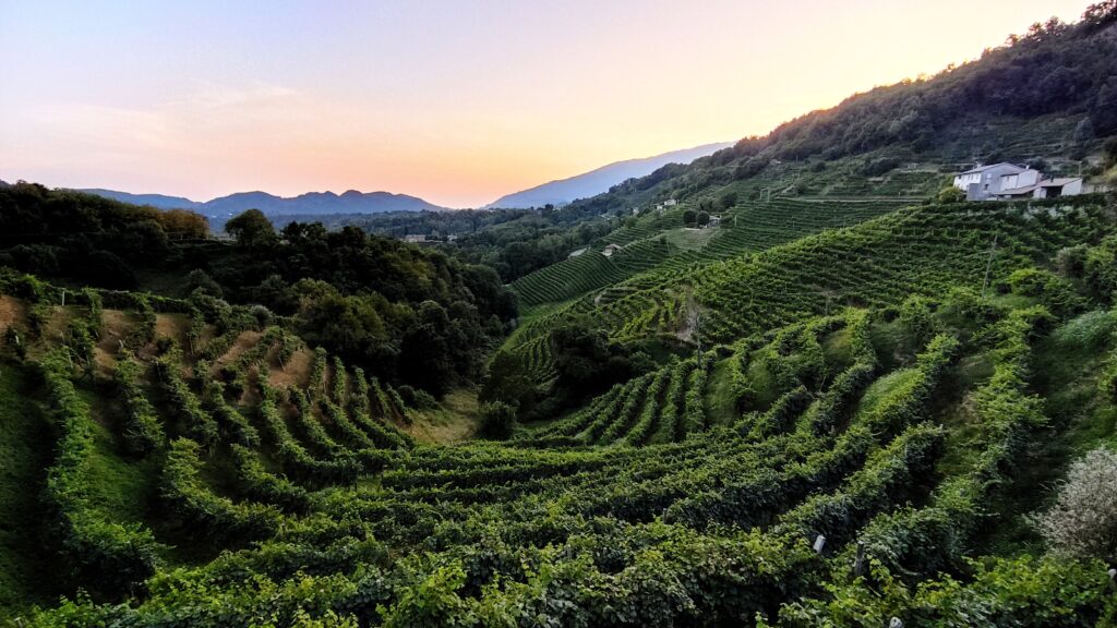
Ca’ Sverio is situated in the eastern part of the Treviso Pre-Alps, a region comprising plains, hills and mountains, characterised by numerous picturesque historic villages that have sprung up on the slopes of the two highest peaks in the Treviso Pre-Alps (Monte Visentin and Monte Pizzoc), from whose summits the entire plain can be seen. As well as its natural and historical beauty, this area is home to a wealth of sites, events and festivals that enrich the visitor experience and will help you get to know the local communities better.
Furthermore, within easy reach for a ‘day trip’, you can visit some of the world’s most famous destinations, such as Venice, the beaches of the Adriatic Sea, the Dolomites and the Prosecco Hills – all UNESCO World Heritage Sites. But we’d also like to recommend a few other destinations – perhaps not quite as famous, but possibly more relaxing – such as the Cansiglio Forest, the lakes of the Treviso Pre-Alps and the Educational Theme Parks of the Alta Marca Trevigiana, all ideal for families and children. Have a lovely holiday!
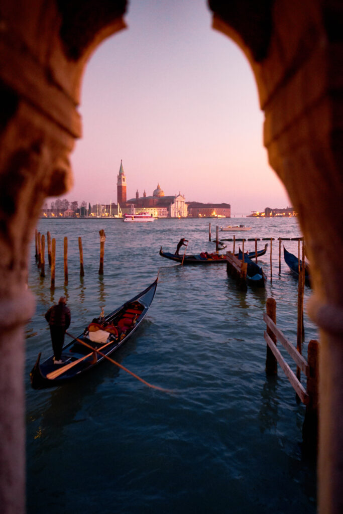
No further explanation is needed. Every year, more than 30 million people choose to visit the City of the Serenissima and its fantastic, warm, sandy coastline.
Climbing aboard a gondola, crossing the Grand Canal via the Rialto Bridge, having a coffee in St Mark’s Square or making a wish whilst passing under the Bridge of Sighs are all experiences that everyone should have at least once in their lifetime. But Venice is so much more than that. Every palace, every alleyway, every square has a story to tell, and often even those who live there for a while or work there fail to discover all the details and secrets this marvellous city conceals. Sometimes, when you open a doorway or peek through a window of any old house, you’ll see frescoed ceilings, rich gilded wooden decorations or incredible sculptures.
But Venice is not just a city. It is the centre of a network of waterways, canals, islands and basins known as the Venetian Lagoon, which is well worth visiting, especially by boat. Islands such as Murano, Burano and Torcello are often described as ‘secondary’ destinations, but they are just as fascinating – and not just because of the master glassmakers who still work on the ground floors of the colourful houses. The lagoon also offers breathtaking panoramas, spectacular views of the Dolomites and encounters with the local wildlife, consisting mainly of seabirds.
The edge of the lagoon, where it meets the Adriatic Sea, gives rise to the splendid beaches of the Lido di Venezia, Jesolo, Eraclea Mare, Caorle and Bibione – summer holiday destinations that attract tourists from all over the world every year.
Useful links:
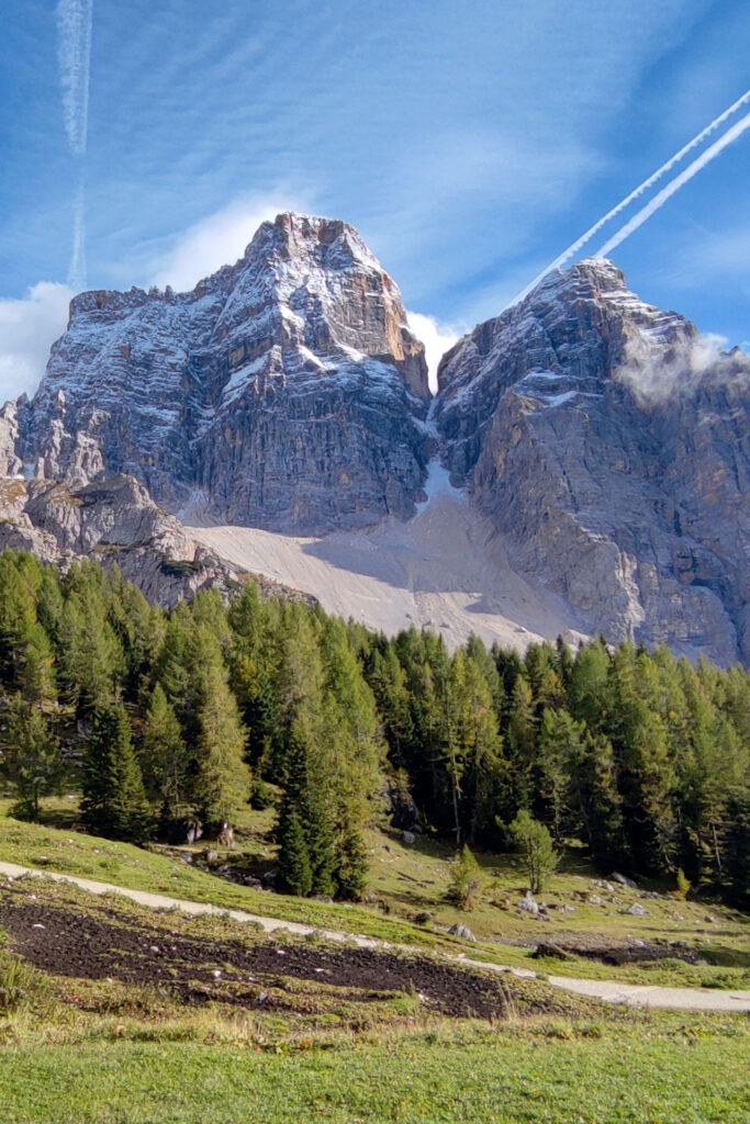
Indeed, from Ca’ Sverio, it takes just over an hour’s drive to reach the ‘UNESCO World Heritage’ mountains, the Dolomites, famous for their white vertical rock faces, which ‘blush’ at sunset, giving rise to that magnificent phenomenon known as ‘Enrosadira’.
In winter, the Dolomites are one of the most famous destinations for skiing, boasting ski resorts of incredible beauty, such as those at Civetta, Cortina d’Ampezzo, Falcade–San Pellegrino, and Padola and Sappada, to name just a few in Veneto. Yes, because contrary to what is often said, as much as 40 per cent of the Dolomites, a UNESCO World Heritage Site, are not in Trentino-Alto Adige but in Veneto – just as Cortina d’Ampezzo, the queen of the Dolomites, is in Veneto. Surprised, aren’t you?
But above all, the Dolomites are about nature, peace and tranquillity – if you know where to go. During the summer,
in fact, there are countless trails criss-crossing the Dolomites, and many of these – whilst absolutely stunning – are not overrun by mass tourism. You don’t need to go climbing or venture along a via ferrata to be alone with nature. If you’d like some advice, do ask us – we’re here to help!
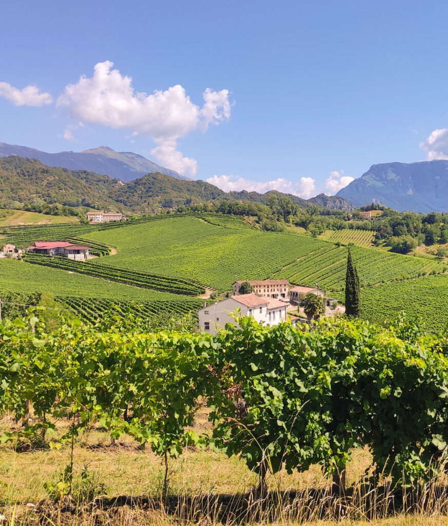
Nestled between two existing UNESCO World Heritage Sites – the Dolomites and Venice (and its lagoon) – another site was recognised as a World Heritage Site in 2018: the Prosecco Hills of Conegliano–Valdobbiadene, which, despite their name, encompass territories that also include the municipalities of Vittorio Veneto and Pieve di Soligo.
A land of ‘heroic winegrowers’, this area has been recognised not only for the beauty of its landscape but also for its long-standing local winemaking and food and wine traditions, characterised by numerous products of excellence and an equally large number of small-scale local producers.
Staying at Ca’ Sverio, whilst remaining a short distance from the large vineyards, you’ll be less than 15 minutes from the ‘heart’ of the Prosecco Hills, a UNESCO World Heritage Site, which can be reached not only by car but also by bus (lines 302 and 303) or by e-bikes (which we provide) in less than half an hour of assisted cycling.
Useful links:
Often ‘overlooked’ compared to its more famous neighbours (Venice, Verona, the Dolomites), the province of Treviso is an enchanting destination for those wishing to avoid mass tourism. Abundant with charming historic villages, protected natural areas and mountains that are not too rugged – ideal for sporting activities – the Marca Trevigiana is gradually attracting more and more visitors, drawn also by the fine food and highly prized wines.
The provincial capital, Treviso, is a little gem surrounded by spring-fed waters, far from mass tourism and brimming with interesting and lively venues, especially at aperitif time – a ‘must’ in these parts. But we mustn’t forget towns such as Castelfranco Veneto (with its walls), Asolo (a real gem), Vittorio Veneto (the town where the First World War ended) and Oderzo (with its Roman ruins). Smaller in size but equally worth visiting are villages such as Cison di Valmarino, Follina, Valdobbiadene, Portobuffolè and Roncade, rich in history and tradition, as well as Silea (with the Sile Park), Revine Lago (with the Revine Lakes, a Natura 2000 site), the Cansiglio Forest (Regional Park) and Montello – all places where you can enjoy lush and bountiful natural surroundings. For those wishing to head up into the hills, we recommend Monte Grappa, Monte Cese, Monte Visentin and Monte Pizzoc, all of which can be reached by car, but are far more picturesque when climbed on foot along the numerous trails that wind their way up them.
Recently, in the northern part of the Marca Trevigiana – known as the Alta Marca – a number of small natural and cultural heritage sites have begun to collaborate to provide activities suitable for families and children, giving rise to the network of Thematic Educational Parks of the Alta Marca Trevigiana. Caves, pile dwellings, pojat (traditional stone huts), olive groves, mills, urban parks, illustrations and frescoes have become attractions where visitors can ‘learn whilst exploring’, discovering ancient knowledge, traditions and customs.
Useful links:
https://www.turismovittorioveneto.it
The Cansiglio is a vast plateau, surrounded by the forest of the same name, situated straddling the regions of Veneto and Friuli-Venezia Giulia, between the provinces of Belluno, Treviso and Pordenone, at an altitude of between 900 m and 1,200 m above sea level. A magical place, where, more than 1,500 years ago, the Republic of Venice would come to gather the timber needed to build the city and later its ships, and where today many people head up to enjoy a bit of cool relief on sweltering summer days or to find snow and go sledging down the gentle slopes surrounding the central plain.
The Cansiglio Forest is a Regional Park, characterised by splendid beech woods and the phenomenon of ‘karst’, which dots the landscape with caves and holes (known, in fact, as ‘bus’), but also by a very large population of ungulates (mainly deer), which in October – the rutting season – attracts countless enthusiasts and photographers, even late at night.
But Cansiglio is also a wonderful place for walks, cycle rides or picnics, not to mention the delicious restaurants, which serve traditional dishes and, above all, local dairy products (we highly recommend trying the ‘yoghurt ice cream’ at Bar Bianco, especially with wild berries!).
Useful links:
Here we enter a hidden world, a ‘hidden gem’ known only to a select few. The valley that rises from Vittorio Veneto towards Belluno and the Dolomites (Val Lapisina) is characterised by a series of lakes, some larger, others smaller, which help to keep the summer evenings in Vittorio Veneto ‘cool’. Lake Negrisiola, Lake Restello and Lake Morto unfold in succession to create a captivating vista, marred only slightly by the pylons of the A27 motorway, built some forty years ago with no regard for the natural surroundings that now encircle it. But that’s not all. Once over the Fadalto Pass, the view opens out onto the ‘lower Dolomites’, but what really strikes the visitor is Lake Santa Croce, a true gem for water sports enthusiasts.
Lake Morto, in particular, and Lake Santa Croce offer, during the summer months, well-maintained, stony and natural beaches where you can enjoy the cool water and take refreshing, revitalising dips, accompanied by bars and cafés where you can grab a sandwich and have a cold drink. But these two lakes also offer strong winds, ideal for kitesurfing or windsurfing, as well as inviting waters and shores for lovely canoe or kayak trips.
Links utili:
https://www.turismovittorioveneto.it/home/citta/ambiente/laghi.html
https://www.naturalmentevittorioveneto.it/v4-giro-lago-morto/
https://www.dolomitiprealpi.it/lago-di-santa-croce-2/#/punti-di-interesse
https://www.dolomiti.it/it/fiumi-laghi-cascate/lago-di-santa-croce-belluno
https://www.dolomiti.it/it/fiumi-laghi-cascate/lago-di-santa-croce-belluno
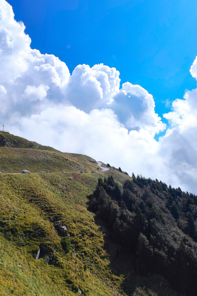
Avete voglia di mettere alla prova le vostre gambe e i vostri polmoni? Bene, questa escursione è quello che fa per voi! Circa 1000 metri di dislivello da percorrere in circa 2 ore e un quarto (un po’ meno se si è ben allenati), lungo un percorso fantastico che, uscendo dal bosco appena dopo il capitello dedicato alla Madonna dell’Agnelezza, offre vedute straordinarie sulla Vallata e sui laghi di Revine (Sito Natura 2000), sulle Prealpi Trevigiane (Monti Visentin e Cesen in particolare), sulla pianura trevigiana e, se il cielo è abbastanza limpido, sul Mare Adriatico e su Venezia.
In cima vi aspetta il Rifugio Vittorio Veneto, con ottimi pasti e, se decidete di passare la notte ai 1.565 metri della cima, un confortevole alloggio.
Il rientro, oltre che per il sentiero percorso all’andata, può avvenire “ad anello” scendendo per località Cadolten, lungo la strada carrozzabile del Santo, che vi riporterà in circa 2 ore al punto di partenza. Per i più allenati e “temerari”, si consiglia la “Direttissima” che, staccandosi dal sentiero descritto poco prima di giungere al Capitello della Madonna dell’Agnelezza, si inerpica piuttosto verticale fino al rifugio Vittorio Veneto, raggiungendolo in meno di un’ora.
Per il rientro, come sopra.
Un percorso ad anello di circa 3 ore e mezza che, partendo dalla Chiesa di San Pancrazio a Montaner di Sarmede, vi porterà fino agli 870 metri sul livello del mare del Col Alt (monumento), passando per il suggestivo Parco dei Carbonai, un luogo magico immerso nella foresta del Cansiglio in cui è possibile conoscere l’antica tecnica della produzione del carbone.
Il sentiero, tabellato CAI (n. 1061), si snoda dapprima sulle dolci pendici che sovrastano l’abitato di Montaner, passando per la Chiesetta del Santo (dedicata a Sant’Antonio e costruita intorno al 1930 su un capitello del 1700), per poi proseguire in salita, a sinistra della stessa, per un breve tratto su sentiero, fino ad incrociare la strada forestale che porta alla località “Col de Faè” a circa 700m sul livello del mare. Da lì, un ombreggiato sentiero vi permetterà di salire, per splendidi boschi di pino, fino agli 850 metri del Parco dei Carbonai, per poi proseguire in falso piano fino al Col Alt, da dove si gode una magnifica vista sulla pianura veneta e friulana.
Il rientro avviene a sud-est verso il Monte Castelir, incrociando il sentiero 1060 e scendendo fino a Borgo Val, dal quale, per la provinciale, si ritorna al punto di partenza.
Durata: 4 ore e 30 minuti circa
La partenza di questo caratteristico sentiero è presso la storica piazzetta di Rugolo, accanto alla celebre chiesa con il portale dipinto dal grande Stepan Zavrel. Da lì, si prosegue verso nord imboccando via Rugolet e si inizia a salire lungo una facile strada asfaltata fino ad un bivio al quale si svolta a sinistra, sempre in salita.
Dopo poco meno di 200 metri, si incontrano due cartelli, entrambi indicanti Cima Castelir: consigliamo di salire lungo il sentiero CAI (n. 1040) che procede dritto tra le case, lasciando sulla destra il secondo percorso, più agevole, da percorrere in discesa sulla via del ritorno.
In breve tempo si sale quindi per boschi e vecchie casere, fino ad incrociare una strada forestale, che si attraversa per continuare lungo il sentiero n. 1040.
Giunti al termine dello stesso, presso una “sella” in cui si incrociano ben 4 percorsi (uno dei quali porta alla Cima della Cima e più in là al Parco dei Carbonai), si sale velocemente sulla destra e in meno di 5 minuti si giunge alla “Chiesetta Castelir”, dalla quale si gode un panorama straordinario su tutta la pianura veneta.
Per il ritorno, si segue ancora il sentiero n. 1040, che ora diventa una comoda carrozzabile in cemento, ma giunti presso un tornante si continua a seguire la strada nonostante le indicazioni per il sentiero n. 1040 portino sulla destra. In questo modo tornerete nuovamente all’abitato di Rugolet e poi a Rugolo, punto di partenza iniziale, in meno di 45 minuti.
Durata: 2 ore e 30 minuti circa
Links utili: